Understand Ground
Motion Everywhere
High-resolution, dense coverage, ground motion analytics for every terrain.
Contact us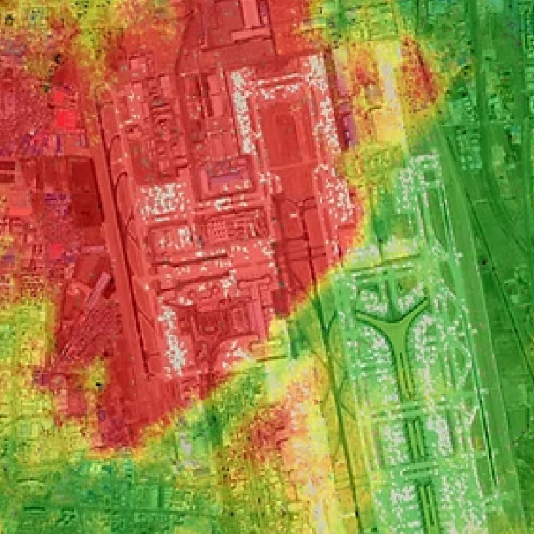
Advanced InSAR Monitoring & Ground Motion Detection Technology
Developed in partnership with the University of Nottingham, APSIS™ (Advanced Pixel System using Intermittent SBAS) is our award-winning algorithm delivering a step-change in InSAR capability. This world-leading technology detects and measures ground surface motion over all land surfaces, including vegetated areas, which is truly unique. Furthermore, APSIS™ delivers the most complete coverage of measurements when compared to other InSAR techniques, and, critical, does so without the need for any ground control or corner reflectors. Terra Motion has also developed a suite of applications to deliver key environmental variables derived from the APSIS™ outputs, opening up new land management and engineering markets and applications that InSAR has never been able to address before.
APSIS™ delivers exceptional sensitivity, measuring changes in relative land surface movement ranging from just a few millimetres to several centimetres per year across a wide range of land cover types, including, agricultural land, forests, and other natural environments such as peatlands, as well as urban areas and critical infrastructure.
With APSIS™, you gain access to:
- High-resolution ground motion and land subsidence maps
- Dense measurements across both urban and rural environments
- Time-series data and average motion, resolved into vertical and lateral vectors
- Easy-to-integrate, high-resolution raster layers for use in open-source and commercial GIS platforms
- Scalable solutions for local, regional, and national InSAR monitoring initiatives
APSIS™ empowers users with a deeper understanding of land stability, supporting a range of applications including infrastructure management, climate resilience, and environmental stewardship, market leading apps, built by Terra Motion using the APSIS™-derived data.
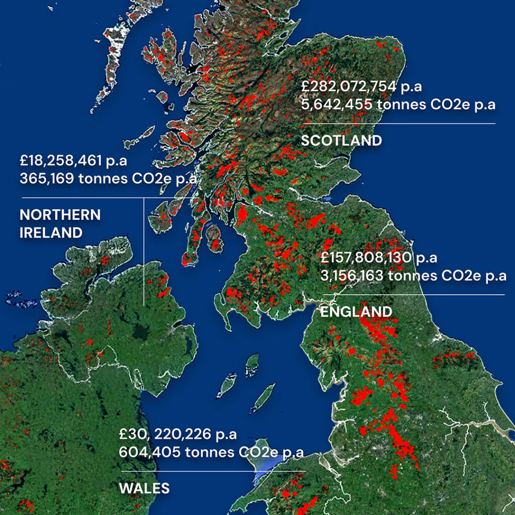
Our Markets – Infrastructure & Peatland Monitoring
At Terra Motion, we deliver advanced InSAR ground motion monitoring analysis to inform critical decision-making across two key markets: infrastructure and peatland management. Our technology helps engineers and planners assess land surface movement and monitor the stability of vital assets, while enabling environmental specialists to classify peatland condition, detect and measure risks of peat-slide, and estimate peatland carbon loss.
Infrastructure – Ground Motion & Land Subsidence Monitoring
Risk Maps for Ground Motion & Land Subsidence
We generate high-resolution risk intelligence that identifies and measures historic ground movement, explains the dynamics of surface heave and subsidence and predicts potential landslides or other related risk events. This information helps to identify at-risk areas, inform identification of the likely causes of ground/asset instability, and supports the formulation of mitigation strategies, assisting asset-level hazard. assessment and management.
InSAR Monitoring Platform for Land Subsidence
Our platform provides engineering teams with access to novel ground motion surface dynamics, including stereo analysis with 2D vectors (vertical and lateral). This unique capability enables regular monitoring, risk assessment, and long-term decision-making for civil structures and linear infrastructure in all terrain conditions.

Peatland Monitoring
Peat Condition Assessment, Peatslide Risk Assessment and Carbon Accounting
Peatland condition monitoring is essential for understanding ecosystem health and climate impact. Based on APSIS™ outputs, and working with the University of Nottingham, we have developed and implemented a sophisticated methodology to assess peatland condition, monitor the impact of peatland restoration activity and calculate the resultant reduction in CO2 emissions
Research by the University of Nottingham and the University of the Highlands and Islands confirms that this approach can accurately classify peatland condition by satellite. As outlined in NatureScot’s technical studies, APSIS™ supports long-term restoration monitoring and peatland carbon loss estimation across highly sensitive and ecologically critical peatland environments.
Peat Slide Risk & Peat Risk Review
Our Peatland Risk app, based upon analysis of APSIS™ outputs, enables early detection of peat mass movement in at-risk areas, where peat slides pose a significant threat to habitats, infrastructure, and valuable peatland landscapes. By monitoring peat instability, we help landowners and other stakeholders conduct a full peat risk review, helping to define appropriate land management actions and reducing both the environmental and financial impacts of damaging peat slides and bursts.
Trajectory of Peatland Motion
APSIS™ captures long-term peatland motion trends, offering insight into how restoration, land use, and climate variables affect peat stability over time. This trajectory data supports peat condition assessment, informing evidence-based restoration strategies and enabling reliable before-and-after comparisons to drive funding and support ongoing Monitoring, Reporting and Verification (MRV).
Peatland Carbon Dynamics
By monitoring surface change, our peatland apps, underpinned by APSIS™ analytics, provide valuable insight into peatland carbon dynamics. Through establishing a CO2 equivalence baseline and then empirically measuring and monitoring the impact of restoration activities, we provide stakeholders with quantifiable data to demonstrate carbon-positive outcomes and secure long-term sustainability.
Our Sectors for Advanced InSAR Monitoring & Ground Motion Detection
Terra Motion is a geospatial technology company pioneering the use of satellite radar to detect and analyse subtle ground motion, land subsidence, and environmental changes. Powered by our patented APSIS™ system, developed in partnership with the University of Nottingham, we process satellite Synthetic Aperture Radar (SAR) data into precise ground motion measurements, and uniquely can do this across all landscape, including vegetated surfaces and without the need for any ground control or corner reflectors. These insights support decision-making across two key markets: infrastructure risk and peatland monitoring, enabling organisations to build resilience and safeguard the environment.
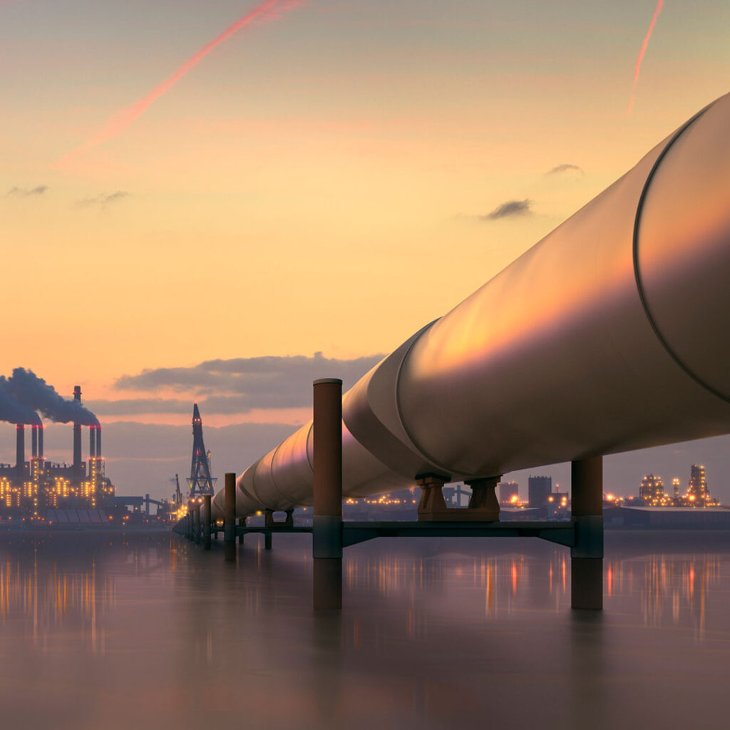
Infrastructure Risk: Ground Motion & Land Subsidence Monitoring
We support infrastructure resilience with high-resolution ground motion and land subsidence mapping powered by APSIS™, crucially including analysis of the surrounding landscape around the asset, providing unique context and threat detection. Our InSAR platform delivers detailed assessment of at-risk assets and ongoing monitoring to assess and predict potential developing threats, helping engineers and planners safeguard critical assets.
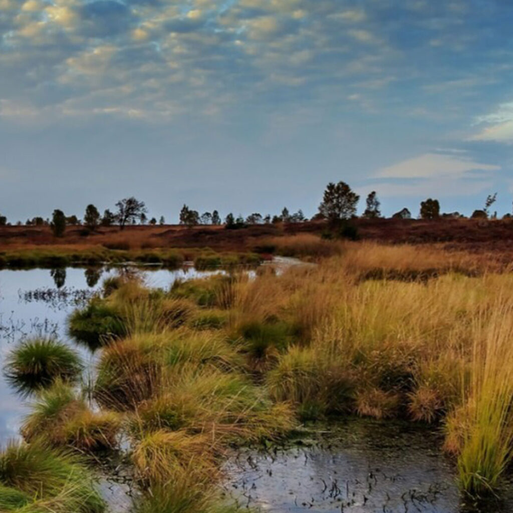
Peat Condition Assessment & Peatland Carbon Loss Estimation
Our technology delivers advanced peatland monitoring, including peat condition assessment, peatland motion trajectory, and peat slide risk analysis. By enabling accurate peatland carbon loss estimation, we provide the information required to develop restoration strategies, inform impact assessment through ongoing monitoring and deliver critical climate reporting intelligence.
Meet the Terra Motion Team
At the heart of Terra Motion is a multidisciplinary team of geospatial analysts, data scientists, software engineers, and industry specialists. With expertise spanning earth observation, environmental science, and satellite analytics, our team combines technical skill with innovative thinking to deliver world-class solutions.
From developing advanced algorithms like APSIS™ to delivering real-world insight, our team provides unique data and derived information to support a range of customer needing comprehensive and accurate ground motion intelligence.
We are committed to helping clients unlock the full potential of InSAR monitoring, driving better outcomes for infrastructure resilience and climate action.


Trusted by industry leaders
Our Partners
Get In Touch to Learn How Terra Motion Can Support Your Project With Powerful InSAR Monitoring & Satellite-Based Land Motion Insights
Take Control of Your Data With Terra Motion
Whether you need advanced solutions for ground motion and land subsidence monitoring, peatland condition assessment and carbon loss estimation, Terra Motion can provide the data-driven intelligence you need.